Selected by the Queensland Government, Advance Queensland, the University of the Sunshine Coast, and Sunshine Coast Regional Council for the Space to Sea accelerator — and a 2026 participant in the CSIRO Innovate-to-Grow R&D program.
The 3D Reconstruction Partner
Behind Your Forensic Team.
3DGS · SLAM LiDAR · DSLR-enhanced texture · drone aerial · ground-aerial fusion · same-day multi-scan fusion · 4DGS change detection. AECT is the spatial-intelligence layer that sits alongside Australian forensic investigators — you keep control of the case, we provide the 3D capture and reconstruction.
Why 2D Photographs and Tape Measurements Aren't Enough
Every modern courtroom has seen a defence team pick apart a hand-drawn scene diagram. The scenes most under-served by traditional capture aren't the obvious ones — they're the ones that “looked simple” on the day.
Spatial Relationships Get Lost
2D photographs flatten distance and angle. Sightlines, trajectories, and relative positions of evidence can't be reconstructed once the scene is released.
Tape Measurements Are Not Repeatable
Once the scene is gone, no defence expert can re-measure. A 3D point cloud lets every party take their own measurements from the same source data, weeks or years later.
Scene Degradation Is Unforgiving
Weather, traffic, contamination, time-pressure to reopen the area. The window to capture is measured in hours, not days — and any gap in coverage is permanent.
Seven Capture Modes — Deployable in Parallel
Six modes for a single capture window plus a seventh for change detection across time. Every AECT scene engagement draws from this stack — we deploy whatever the scene actually demands. Most same-day jobs combine three or four modes; multi-visit engagements add the time dimension on top.
3DGS Photoreal Scene Capture
Photoreal radiance fieldsXGRIDS PortalCam + LCC platform produce a fully photorealistic, browser-navigable model of the scene. Lighting, colour, and surface texture are preserved with sub-pixel fidelity — every angle the investigator might want to revisit later is captured in one walk-through. Ideal for jury-visible exhibits, walk-throughs, and re-examination after the scene has been released.
SLAM LiDAR — Indoor / GPS-Denied
Survey-grade geometry, GNSS-freeXGRIDS Lixel K1 / K2 SLAM LiDAR captures centimetre-level relative accuracy point clouds in environments where GPS fails — interiors, basements, tunnels, stairwells, vehicles, shipping containers. Walk the scene once: dimensions, sightlines, sectional analysis, and measurement-ready data come out the other side, no tripod re-setups.
DSLR High-Detail Pass — 3DGS Texture Enhancement
Hero-detail photography baked into the 3DGS sceneFull-frame DSLR with macro and tripod-stabilised optics for hero-detail close-ups of areas the investigator wants resolved at higher pixel density than SLAM-LiDAR or PortalCam alone provides — engravings, serial numbers, evidence-tag details, weapon marks, footwear impressions, latent traces under oblique light. The high-resolution stills are then registered back onto the 3DGS scene as a texture-enhancement pass, so when the model is walked through later, those critical areas resolve at near-print quality. DSLR is used as an enhancement layer for the 3DGS reconstruction — the primary forensic record is the 3DGS / point-cloud, not the photographs in isolation.
Aerial-Only Survey
Wide-area drone captureDJI M350 RTK or M400 with Zenmuse L2/P1 payloads for orthomosaic, DEM, and aerial point-cloud capture across large outdoor scenes — vehicle collisions on rural roads, search areas, dump sites, crash and fire grounds, bushland recoveries. Full flight-log archive, sub-3 cm vertical accuracy at 150 m AGL.
Aerial + Ground Fusion
Two viewpoints, one modelSingle-scene fusion of drone-aerial capture (overhead context, perimeter, escape routes) with handheld SLAM LiDAR (interior detail, beneath canopy, under cover). The combined point cloud is registered to a single coordinate frame so investigators see the full scene from any angle without the gaps a single sensor would leave.
Multi-Capture Scene Fusion
Multiple same-day scans, one unified sceneWhen one walk-through can't cover the whole scene — multi-storey buildings, large outdoor compounds, vehicles plus surrounding ground, interior plus immediate exterior — we run multiple captures in parallel on the same day and fuse them into a single geo-referenced master inside LCC. Different operators, different sensors (handheld + drone + DSLR), same coordinate frame. The investigator walks one model, not six. Hash-verified per-capture provenance manifest stays attached to the master file.
4DGS Change Detection — Same Scene, Different Times
Time-aware Gaussian Splatting for evolving scenesWhen the same scene is captured on multiple separate days — initial response, 24-hour return, one-week follow-up, or years later for cold-case re-walk — the captures can be registered into a single 4D Gaussian Splatting model. The investigator scrubs through time inside the same coordinate frame: scene at T+0, T+24h, T+1 week. Useful for progressive structural collapse, bushfire / arson forensics (before vs after burn pattern), decomposition timelines, cold-case archive comparison against current site state, and Coronial-Court timeline exhibits where the question is "what changed and when". Each timepoint keeps its own hash-verified provenance.
Where AECT Full-Scale 3D Can Be Used
Eight investigation contexts where our 3D capture and reconstruction stack adds value alongside the agency's own forensic experts. We provide the data and the model; the agency's forensic team provides the interpretation.
Crime Scene Reconstruction
Indoor & outdoor scene documentation for homicide, sexual assault, and serious-injury investigations. Full 3D walkthrough preserved after the scene is released back to the public.
Vehicle Collision Investigation
Sub-cm geometry of road-crash sites — vehicle deformation, skid marks, sightlines, debris field. Pairs with crash-reconstruction software (PC-Crash, Virtual CRASH).
Fire & Arson Scene Forensics
Burn-pattern documentation and structural analysis of fire grounds. Capture before collapse risk forces demolition. Pairs with origin-and-cause investigators.
Search & Body Location
Bushland, mineshaft, water-margin, and remote-area searches. Drone thermal + LiDAR scans the search box; SLAM handheld captures the discovery scene without disturbance.
Cold Case Re-Walk
Re-document active and historical scenes years after the event. Map-fusion stitches modern captures into archival diagrams for re-investigation or appeal proceedings.
Coronial Inquiry Documentation
Court-ready 3D exhibits for state coroners and inquest counsel. Geo-referenced, timestamped, hash-verified evidence packs with chain-of-custody manifest.
Workplace Fatality / SafeWork
Comcare, SafeWork, and state regulator investigations. Capture before the site is cleared — preserves spatial relationships, machine guarding, and PPE positioning.
Defence & National Security
Sovereign-data workflows for defence, federal and state-level critical-infrastructure investigations. Onshore-only processing, optional air-gapped delivery, ISO-approach controls.
What the Record Looks Like
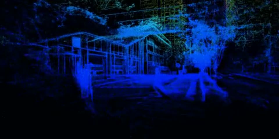
Millimetre-level point clouds and photoreal 3DGS — a scene you can re-enter, measure, and present long after the tape comes down.
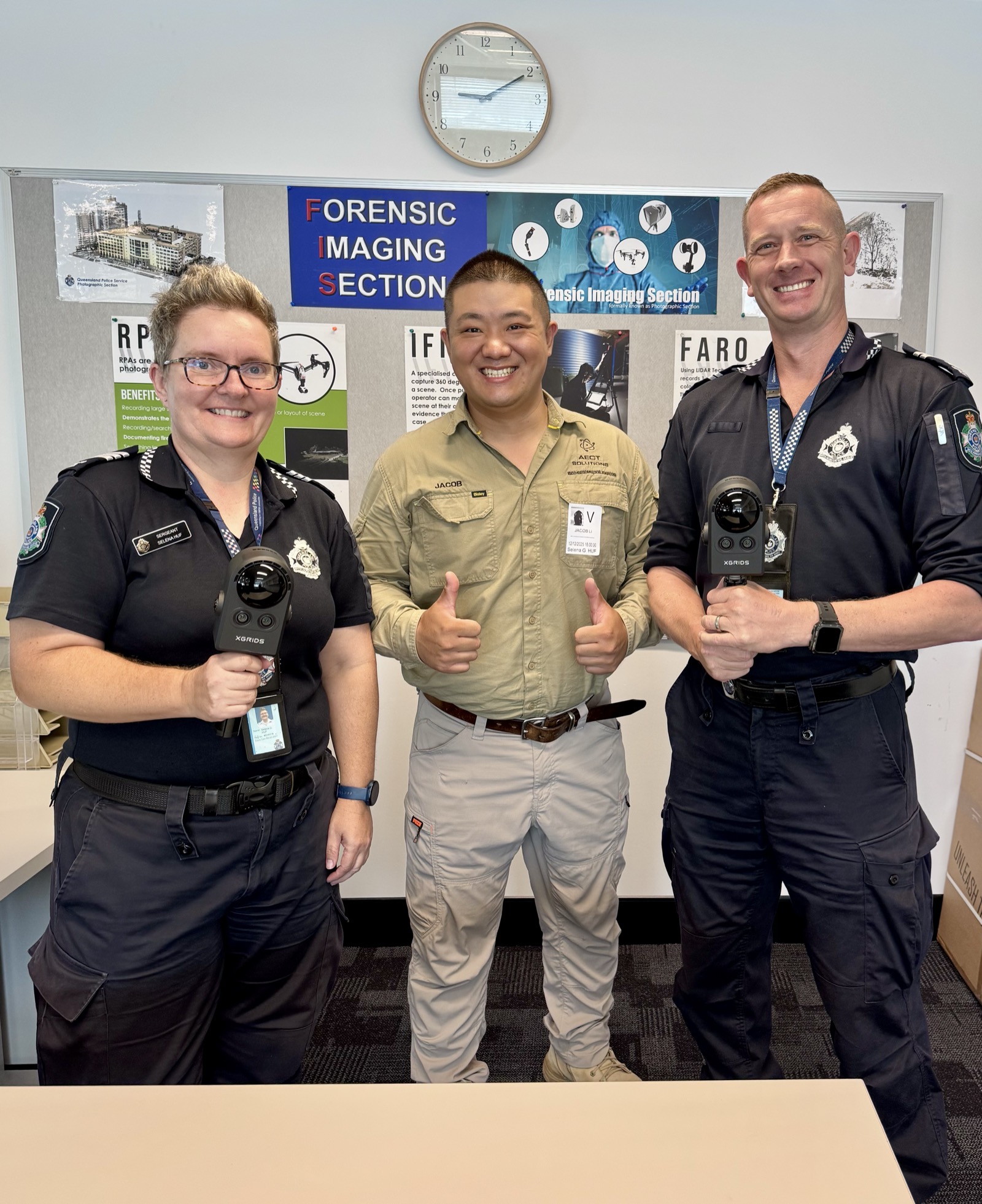
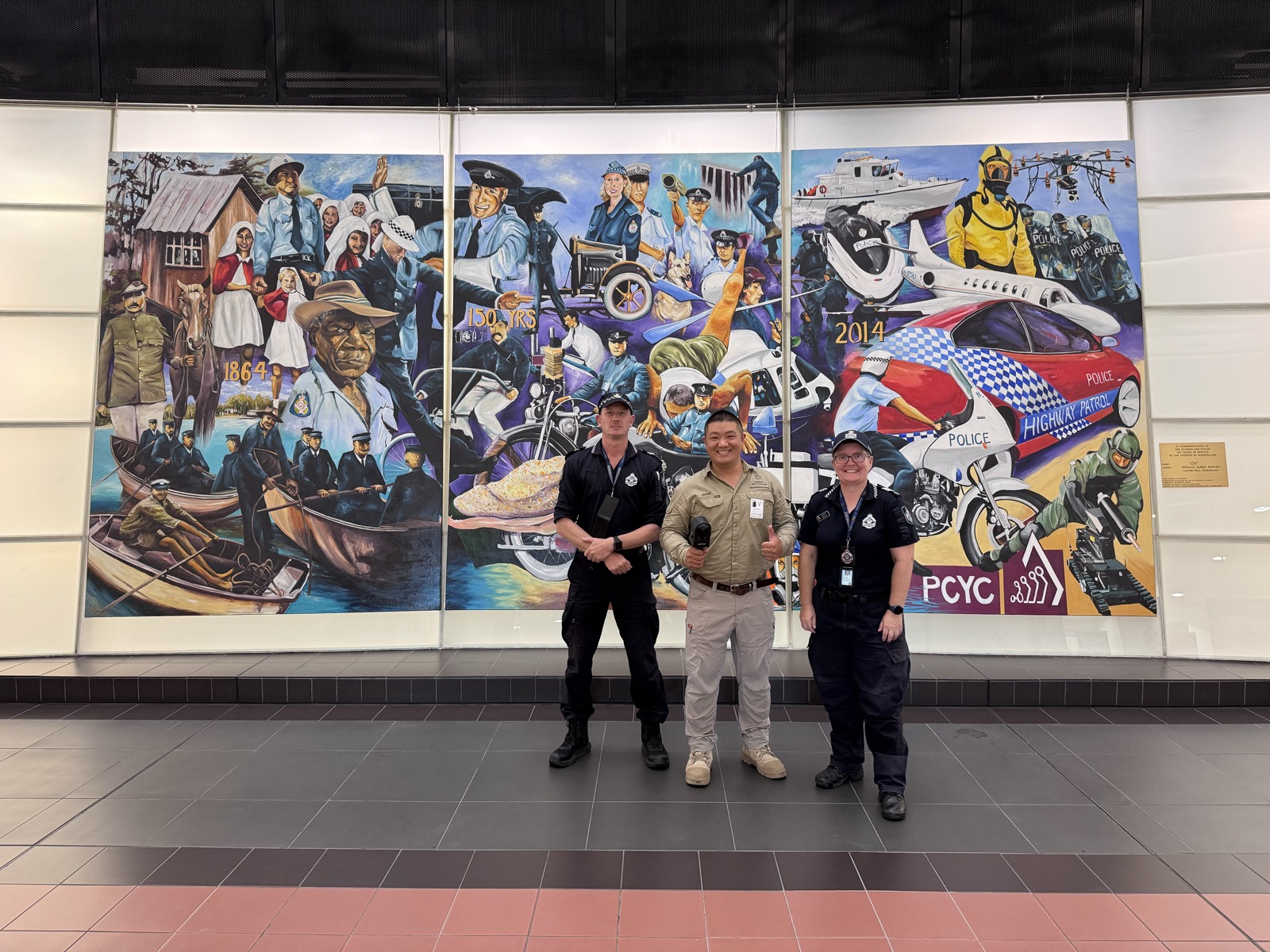
3D Reconstruction Consultant & Partner
We are not a forensic service provider, expert-witness firm, or chain-of-custody custodian. We are the 3D capture and reconstruction partner that sits alongside your forensic team — you stay in control of the investigation, we provide the spatial intelligence layer.
- →Field 3D capture across the seven modes above
- →LCC / LixelStudio reconstruction and registration
- →Scale-correct 2D and 3D exhibits, browser-viewable models
- →Measurement extracts on request from the forensic team
- →Onshore processing in Australia — no offshore sync
- →Expert interpretation — cause, manner, attribution
- →Evidence handling and chain of custody on the scene itself
- →Court testimony and expert opinion
- →Investigation strategy and legal direction
- →Final exhibits filed with the brief of evidence
- →State and federal police investigators
- →State Forensic Science Service labs (NATA-accredited)
- →Retained forensic accident reconstructionists
- →Coronial counsel and the State Coroner's office
- →Fire-investigation, structural, and insurance experts
This separation is deliberate. Keeping the 3D capture role distinct from forensic interpretation means the data sits cleanly inside the investigating agency's evidence framework, not inside an external vendor's.
How We Work Together
AECT engages as a 3D reconstruction consultant and partner, not a forensic service vendor. Engagement scope, deliverable format, and integration with the agency's existing forensic process are agreed up-front so the spatial-intelligence layer slots cleanly into the case file the investigator already has open.
Project engagements are scoped and quoted per case. Retainer or framework arrangements are available for agencies and forensic firms with recurring case-load — pre-agreed daily rates, response window, and a known partner contact.
Brisbane / Sunshine Coast metro response is typically same-business-day where requested early. Regional Queensland and interstate is via direct deployment or our partner network, scoped per case.
Discuss a 3D Reconstruction Partnership
Email Jacob Lee directly to start a confidential conversation about how AECT can sit alongside your forensic team. All enquiries from .gov.au, partner-agency, and forensic-services-firm domains are routed direct.
Selected by the Queensland Government, Advance Queensland, the University of the Sunshine Coast, and Sunshine Coast Regional Council for the Space to Sea accelerator — and a 2026 participant in the CSIRO Innovate-to-Grow R&D program.
This page is a non-public capability statement maintained by AECT Solutions for agency briefings. AECT Group Pty Ltd · ABN 44 659 415 326 · Collider, UniSC Innovation Centre, 90 Sippy Downs Drive, Sippy Downs QLD 4556. Page last reviewed: May 2026.