SLAM Surveying & the Skills Shortage: A Fusion Workflow Guide
SLAM won't replace your total station or TLS. How Australian survey firms fuse SLAM, GNSS RTK, total station, terrestrial laser scanning and 3D Gaussian Splatting to stretch scarce survey skills, with a K2 / L2 Pro / L3 chooser and FAQ.
Australia's survey sector needs a minimum of 1,500 new professionals every year just to meet baseline requirements, and the shortfall is projected to compound to more than 2,000 a year by 2029. SLAM scanning won't close that gap by replacing surveyors, total stations, GNSS RTK or terrestrial laser scanners. It helps when it is built into a fusion workflow: survey control and independent checks stay with the surveyor and their instruments, terrestrial laser scanning covers the tightest tolerances, rapid SLAM capture covers everything in between, and 3D Gaussian Splatting makes the result readable for everyone on the project. That is how each skilled hour goes further, from planning through construction to as-built handover.
This guide is for Australian survey practices, engineering surveyors, digital engineering leads and AEC project teams who want to use SLAM properly: as one layer in a system, not a shortcut around one. A shorter version first ran on LinkedIn as SLAM won't replace your total station and TLS.
Quick answers: frequently asked questions
Can SLAM LiDAR replace a total station or a terrestrial laser scanner?
No. SLAM is a rapid mobile capture method that complements the total station, GNSS RTK and terrestrial laser scanning (TLS) rather than replacing them. Control, independent validation and sign-off stay with the surveyor. Transport for NSW's Digital Engineering Survey Requirements Guide, for example, says validation measurements must use a survey-independent method, such as a total station when validating a laser scan survey.
How do you combine SLAM with RTK, a total station and TLS in one survey workflow?
Set the control framework with GNSS RTK and the total station and keep independent check points aside, capture tight-tolerance elements with TLS, capture everything else with SLAM overlapping control and the static scans, register the SLAM data to control and fuse it with the TLS data, validate against the check points, and deliver the result in layers: point cloud, mesh, 3D Gaussian Splatting, and BIM or GIS outputs.
How accurate is SLAM surveying with the XGRIDS Lixel K2, L2 Pro and L3?
XGRIDS specifies 1 cm RMSE relative and 3 cm RMSE absolute accuracy for the Lixel K2 with its built-in RTK, 1 cm relative and 3 cm absolute after post-processing for the Lixel L2 Pro, and 5 mm relative accuracy (1σ, in a 500 m² test) with 2 cm absolute RMSE for the Lixel L3. Whether that is accurate enough depends on the tolerance of each deliverable, which the surveyor decides.
What is rapid spatial capture?
Rapid spatial capture means recording a site in 3D while moving (walking with a handheld scanner, wearing a backpack, driving a vehicle or flying a drone) instead of setting up a static instrument at each station. SLAM (simultaneous localisation and mapping) works out the scanner's position as it moves, so large or complex areas can be captured in a single pass and tied back to survey control.
How big is Australia's surveying skills shortage?
Surveyors Australia reported in March 2026 that the sector needs a minimum of 1,500 new professionals a year to meet baseline requirements, projects a compounding shortfall of over 2,000 professionals a year by 2029, and found that 86.1% of surveying firms have severe difficulty filling licensed surveyor vacancies, against a $1.14 trillion infrastructure pipeline over the next five years.
What does 3D Gaussian Splatting add to survey deliverables?
3D Gaussian Splatting (3DGS) turns a capture into a photoreal 3D scene that anyone can explore in a web browser. It adds visibility, not measurement: measurements stay in the point cloud, while the 3DGS scene lets clients, designers, builders and asset owners understand the site without specialist software or another site visit.
Which XGRIDS scanner suits which survey job?
The Lixel K2 suits everyday rapid capture such as as-builts, progress records and existing conditions. The Lixel L2 Pro suits range and platform flexibility for corridors, large sites, and vehicle- or drone-mounted capture. The Lixel L3 suits survey-grade handheld work, where the deliverable has to sit beside TLS and total station data. All three produce point clouds through LixelStudio and 3DGS scenes through LCC.
Key terms
- →SLAM (simultaneous localisation and mapping): a scanner works out its own position while it maps, so it can capture on the move.
- →GNSS RTK (real-time kinematic): real-time satellite positioning with corrections, used to place data in real-world coordinates.
- →Total station: an instrument that measures angles and distances to set and check control to high accuracy.
- →TLS (terrestrial laser scanning): static, tripod-mounted laser scanning for high-accuracy capture.
- →3DGS (3D Gaussian Splatting): a photoreal 3D scene reconstructed from captured imagery and geometry.
- →Fusion workflow: several capture methods combined under one control framework and delivered as one dataset.
Australia's surveying skills shortage in numbers
Surveyors Australia's March 2026 analysis puts the problem plainly. The sector needs "a minimum influx of 1,500 new professionals annually just to meet baseline requirements". It projects a "compounding workforce shortfall of over 2,000 professionals per year by 2029". "86.1% of surveying firms" are "experiencing severe difficulty filling licensed surveyor vacancies", all against a "$1.14 trillion infrastructure pipeline mapped out over the next five years."
The same piece makes a point that is easy to miss: the industry needs skills in GIS, 3D laser scanning and LiDAR, and education has not kept pace. This is a capability gap as much as a headcount gap. Even firms that can recruit are recruiting into a toolset that has moved faster than the training pipeline.
Why SLAM complements survey instruments instead of replacing them
The pitch you often hear is that SLAM means you don't need a surveyor. It's wrong, and it's bad for the industry. Look at how a major asset owner writes the rules.
Transport for NSW's Digital Engineering Survey Requirements Guide (DMS-SD-142) expects survey contractors to provide qualified surveyors "to direct and be responsible for all survey work." Its validation section is blunt: validation measurements "must be captured using a survey independent method, for example when doing a laser scan survey use a total station for validation purposes." The same guide lists handheld, backpack and vehicle-mounted laser scanning as recognised mobile capture methods.
Read together, that isn't a barrier to SLAM. It's the blueprint for using it properly. Control, datum, independent checks and sign-off stay with the surveyor and the instruments built for them. SLAM's job is to capture everything around that framework, fast and in 3D, so the surveyor's time goes on judgement instead of walking every metre of the site.
We are seeing more and more fusion workflows across the industry, and the hardware is being designed for it. XGRIDS validated the relative accuracy of its new Lixel L3 against a total station across 1,524 distances, using 7 units and 20 scans. The L3 also collects control points with a standard RTK survey pole. That's a SLAM scanner built to sit inside survey practice, not outside it.
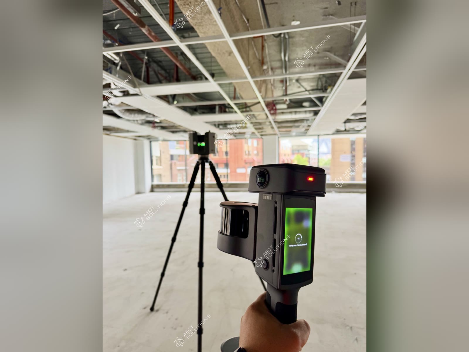
SLAM LiDAR and Leica RTC data fusion testing with one of the global leading engineering firms (first group of L3 users in Australia)
The fusion workflow: four layers, one control framework
A fusion workflow assigns each instrument the job it does best and ties everything to one coordinate framework.
- →Control: GNSS RTK and the total station establish the coordinate framework, with independent check points verified by total station. This is the backbone, and it belongs to the surveyor.
- →Precision static capture: terrestrial laser scanning goes where tolerances are tightest, such as structural interfaces, critical plant and anything a tight accuracy class demands.
- →Rapid mobile capture: handheld, backpack, vehicle or drone-mounted SLAM covers the ground between, including interiors, corridors, GNSS-shadowed areas, complex geometry and the weekly progress walk. It is tied in with control points, RTK and overlap with the static data.
- →The visual layer: 3D Gaussian Splatting turns the same capture into a photoreal scene that a client, a designer interstate or a site manager can open in a browser.
Then you close the loop: check the mobile data against independent points, record what you checked, and deliver. The value of the system doesn't come from any single instrument being faster. It comes from using each one where it earns its keep, so nothing gets captured twice.
Step by step: a fusion workflow on one job
1. Agree the deliverables first
For each element, settle with the surveyor what accuracy it needs and who signs it off. That decides which areas get TLS and which get SLAM.
2. Set control, and keep some back
Establish the framework with GNSS RTK and the total station, and hold back independent check points the mobile capture won't use.
3. Capture static where tolerance demands it, and mobile everywhere else
Plan the mobile route so it overlaps control and the static scans.
4. Register and fuse
Tie the SLAM data to control. For the K2, L2 Pro and L3, XGRIDS' guidance is at least three control points, no more than 50 m apart and never in a straight line. Then merge it with the TLS data. In LCC, Map Fusion combines multiple scans and Aerial-Ground Fusion brings drone and ground data together.
5. Validate independently
Compare against the check points using a survey-independent method, and record what you checked and what you found.
6. Deliver in layers
Deliver the point cloud (LAS/E57/RCP) for measurement, a mesh (OBJ/OSGB) and a 3DGS scene for visibility, and BIM or GIS outputs where the project needs them. See AI scan-to-BIM and digital twins.
Right tool, right tolerance: Lixel K2, L2 Pro and L3
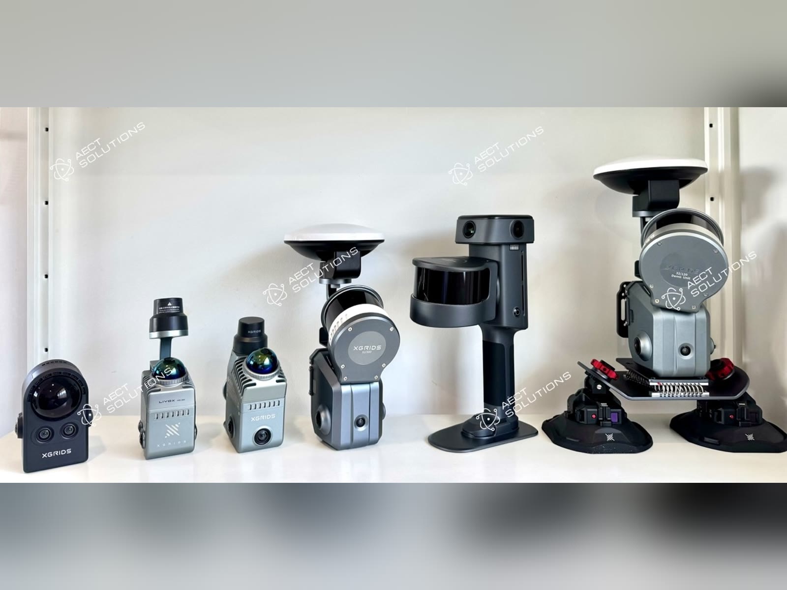
Australia's largest XGRIDS demo fleet: AECT Solutions, XGRIDS National Distributor (AU)
These are the three XGRIDS scanners we most often map into survey workflows.
Lixel K2: the everyday rapid-capture tool. Under 1 kg with RTK built in. XGRIDS specifies 1 cm RMSE relative and 3 cm RMSE absolute accuracy, and the point cloud builds in colour as you walk. It's light enough to take on every site visit for as-builts, progress capture, pre-pour records and existing-conditions context. Its RTK works outdoors only. Inside, you tie it to control.
Lixel L2 Pro: range and platforms. One scanner that works handheld, on a backpack, on a vehicle or mounted on a drone, with 120 m and 300 m range configurations. Post-processed accuracy is 1 cm relative and 3 cm absolute, with Standard or Survey-grade RTK. It's built for corridors, large sites, stockpiles and mobile mapping, where covering ground is the whole job. Plan for two limits: drone mode has no Map Fusion (registration is manual or ICP-based with good overlap), and vehicle mode doesn't produce 3DGS.
Lixel L3: survey-grade handheld. XGRIDS specifies 5 mm relative accuracy (1σ, in a 500 m² test) and 2 cm absolute RMSE, with survey-grade GNSS built in, control-point collection on a standard RTK pole, and on-screen preview and measurement. Outputs include LAS, E57, RCP, mesh, 3DGS and 3D Tiles. It's the handheld you bring when the deliverable has to stand next to your TLS and total station data. Pricing is on enquiry and demos are in person. See the L3 launch overview.
All three produce point clouds through LixelStudio and 3DGS through LCC. And all three still need what every survey dataset needs: control, independent checks and someone qualified to say what the data is fit for. For how point clouds, photogrammetry and 3DGS compare as deliverables, see LiDAR vs photogrammetry vs 3DGS.
3D Gaussian Splatting: visibility from planning to handover
This is the part of fusion that changes the conversation with everyone who isn't a surveyor. A point cloud carries the measurement. A 3DGS scene carries the understanding: what the site actually looks like, from any angle, in a browser. Both come from the same capture.
- →Planning: existing conditions for design review, stakeholder engagement and constraints checks, without another site visit.
- →Construction: progress and hold-point records the whole project team can see, compared against design and the last capture.
- →Handover: the as-built point cloud for the engineers, and a photoreal twin the asset owner and facility managers can navigate.
One honest limit: a 3DGS scene isn't a measurement deliverable on its own. Measure in the point cloud, and use the splat to show it. For why a navigable model beats a static report at handover, see digital twin vs PDF report.
What a fusion workflow means for the skills shortage, and for ROI
- →Senior surveyor hours go on control, QA, validation and sign-off: the parts only they can do.
- →Trained capture operators extend that reach under the surveyor's direction, a faster pathway into the industry than waiting for every role to be filled by a new graduate.
- →Capture once, use many times: one mobile capture serves the surveyor, the designer, the builder and the asset owner.
- →Fewer revisits and fewer queries, because the deliverable is something people can open and understand.
Be wary of generic ROI multipliers; many don't survive a check against their source. Measure your own on one job run the old way and one run as a fusion workflow:
- →Field hours per deliverable
- →Site revisits per job
- →Senior-surveyor hours per project
- →Turnaround from capture to delivery
- →Queries and RFIs raised against the survey deliverable
How AECT Solutions delivers fusion workflows end to end
AECT Solutions was started to tackle industry pain points, and the capability shortage was one of them from day one. That's why we work end to end rather than just selling boxes:
- →The hardware, as the XGRIDS National Distributor for Australia
- →Onboarding and training
- →Dry hire and Demo-to-Buy, so a firm can prove a workflow on a live job before committing capital
- →Capture and processing services, processed 100% onshore for data sovereignty
- →A partner program for survey and engineering firms who want to deliver this themselves
Our stack runs from metrology-grade and terrestrial laser scanning through handheld SLAM and 3DGS to vehicle and aerial capture. We don't push one instrument. We help design the system.
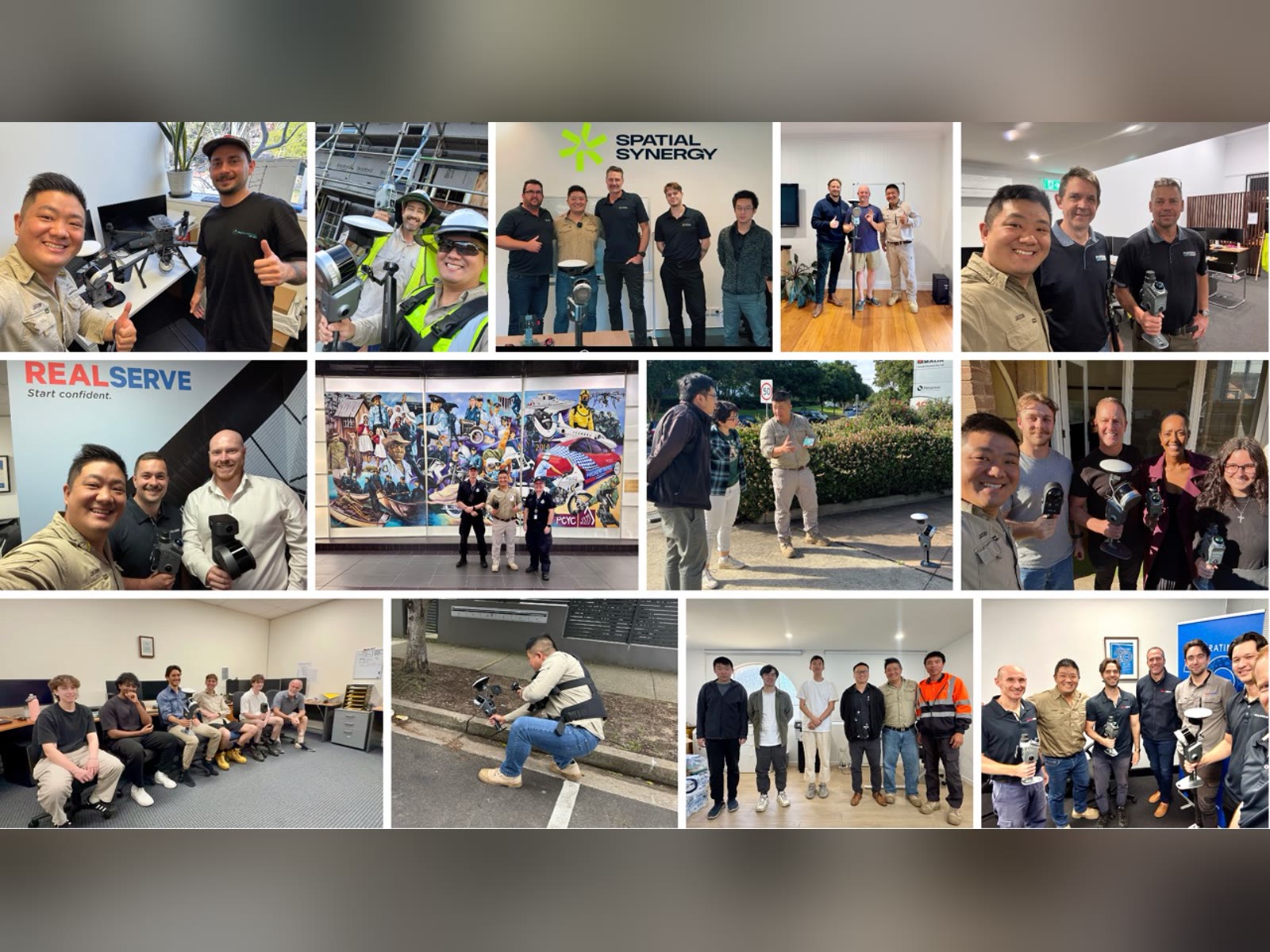
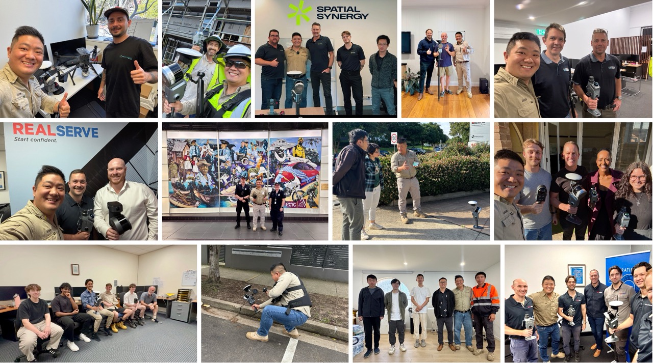
Since 2024, we have helped surveying and spatial-capture companies integrate SLAM into their existing workflows nationwide.
If you run a survey or engineering practice, send us one current job. We'll map where SLAM and 3DGS slot in beside your RTK, total station, TLS and drone, and where they don't.
Sources
- →Surveyors Australia, Navigating the crisis: Australia's surveying skills shortage threatens trillion-dollar infrastructure pipeline, 17 March 2026.
- →Transport for NSW, Digital Engineering Survey Requirements Guide, DMS-SD-142 v1.1 (December 2022), section 3.4.5 Validation.
- →XGRIDS product specifications for the Lixel K2, Lixel L2 Pro and Lixel L3 (L3 brochure, September 2026).
Related Articles
Talk to Our Team
Every article is backed by real project experience. Book a discovery call and let's discuss your specific project.