Preserving Queensland's built heritage with 3D Gaussian Splatting — and which XGRIDS scanner to use for the job
Photorealistic, non-destructive, browser-viewable: how AECT documents heritage buildings to the standard an approval actually expects — and where the new Lixel L3, the K2, the L2 Pro and PortalCam each fit in a heritage capture.
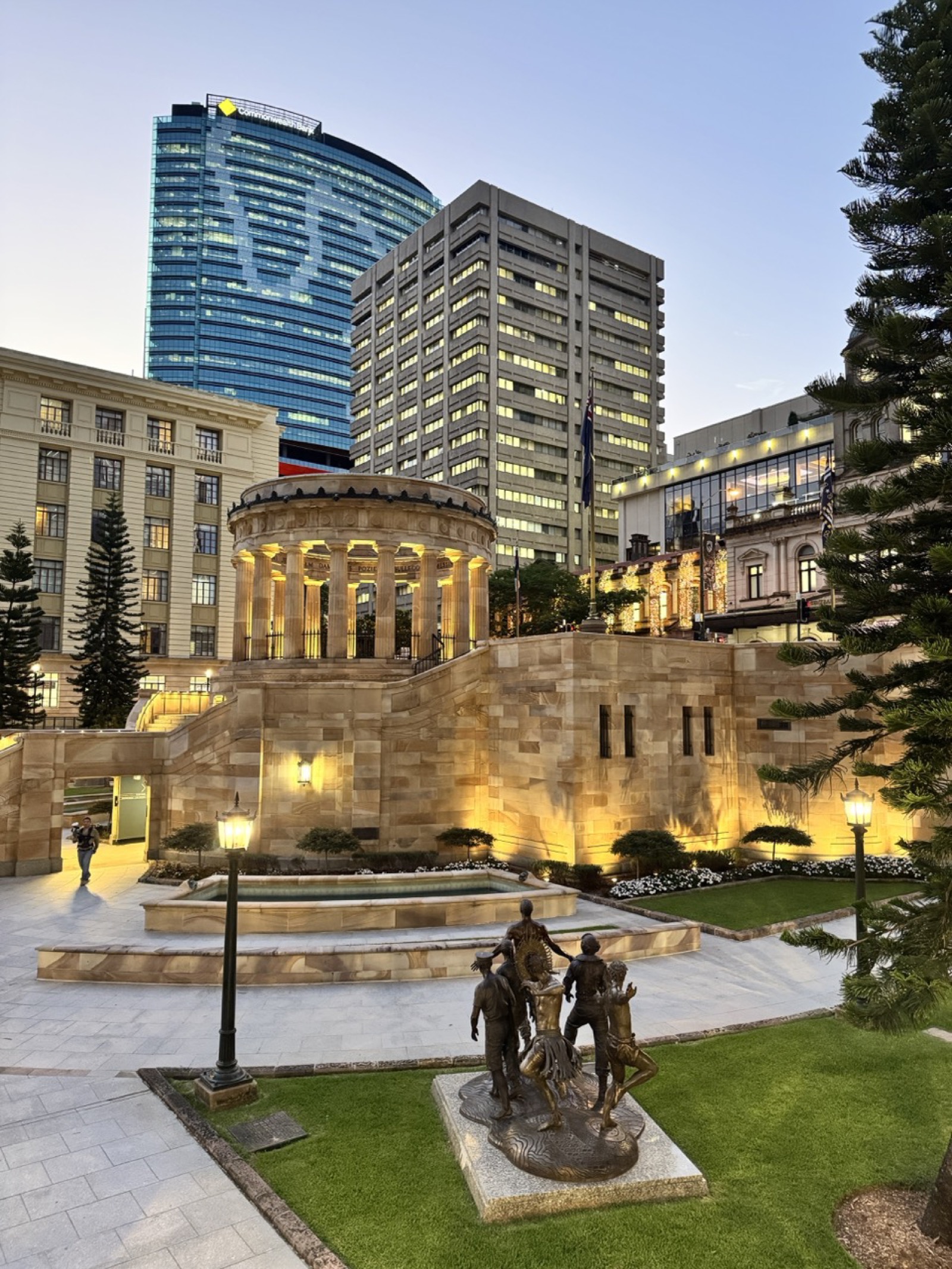
You have been engaged to document a nineteenth-century Queenslander, a Federation-era public hall or an interwar industrial building before works begin. The heritage officer wants a verifiable record. The conservation architect needs measured drawings. The register listing requires evidence of significance. And the client wants to share the documentation with stakeholders who have no specialist software installed.
Traditional surveys take days. A folder of photographs is not a measured record. Photogrammetry struggles with the ornate cornices, polished timber floors and fretwork that define Queensland heritage buildings. Static terrestrial laser scanning needs a tripod setup in every room — heavy equipment, slow repositioning, and disruption to tenants, collections and artefacts. There is now a better way, and since 15 September 2026 it has a new flagship.
Why 3D Gaussian Splatting changes heritage documentation
3D Gaussian Splatting (3DGS) produces photorealistic, walkable 3D models from camera imagery — not a smoothed polygon mesh, but millions of volumetric primitives that keep genuine visual fidelity, surface texture and colour at the same time. Anyone can navigate the result in a standard web browser. For heritage buildings this matters in three ways.
- →Ornate surfaces captured faithfully — decorative plasterwork, timber joinery, masonry coursing and leadlight glass render as they are, not as an approximated mesh.
- →Accessible to everyone — heritage officers, conservation architects, planners and community stakeholders inspect the documentation without installing anything.
- →Time-stamped and verifiable — the model is a spatial record of a building's condition at a specific date, paired with a survey-grade point cloud where measurements are needed.
AECT Solutions is the XGRIDS National Distributor for Australia, so the capture stack below is the gear we sell, hire, support and use on our own heritage jobs — the PortalCam 3DGS camera, the handheld SLAM LiDAR range (the new Lixel L3, the Lixel K2 and the Lixel L2 Pro) and LCC (Lixel CyberColor) for processing and delivery.
Which scanner for which heritage job
Four units, four different jobs. The honest answer to "which one" depends on what the approval condition or the architect actually needs from the record.
- →PortalCam — an 870 g, four-camera 3DGS array with a 0.1–30 m LiDAR for scale, ±2 cm relative accuracy, no RTK and no point-cloud output. The photoreal walkthrough: interiors, museums, listing records, stakeholder review in a browser. One operator, under an hour for a typical dwelling.
- →Lixel K2 — under 1 kg with built-in RTK and three cameras; a point cloud and a 3DGS scene from the same walk at around 1 cm relative and 3 cm absolute accuracy. The everyday unit for condition records, smaller dwellings and quick pre-works baselines.
- →Lixel L3 — XGRIDS' new flagship, launched 15 September 2026: 5 mm relative accuracy, 2 cm absolute with survey-grade RTK built in, three 1/1.3-inch 4K HDR cameras, a 4.3-inch on-device display, on-device loop closure and a low-feature mode for stairwells and plant rooms. Local upsampling lifts point density to 1–5 mm on the details that matter — a capital, a cornice, a joinery profile. This is the unit for measured drawings and Scan-to-BIM, and its HDR cameras hold colour in dim interiors and against glare from leadlight.
- →Lixel L2 Pro — the long-range option: 32-channel LiDAR to 300 m, 1 cm relative and 3 cm absolute, dual 48 MP cameras, vehicle mounting and drone mounting on the DJI Matrice 300/350. Large precincts, church and hall exteriors, and aerial–ground fusion into one dataset.
Most heritage projects now pair the PortalCam for the photoreal record with the Lixel L3 for the measured survey, in one site visit. The L2 Pro takes over on large precincts and wherever drone fusion is needed; the K2 is the practical choice when budget or weight matters more than the last few millimetres. The full side-by-side table is on the L3 page.
The AECT heritage documentation workflow
1. Pre-capture assessment and scope
Before equipment enters the building we review the register listing, identify the documentation requirements under the Queensland Heritage Act 1992, and scope access permissions — liaising with the state heritage branch or the local council where required.
2. PortalCam 3DGS capture
A single operator walks the 870 g PortalCam through the building. Its four-camera array (two 200° × 200° fisheye and two 100° × 85° forward lenses) captures continuous overlapping imagery at 4,000 × 3,000 px per camera, anchored to real-world scale by its integrated Class 1 LiDAR. A typical heritage dwelling — interior and exterior — takes under 60 minutes. No tripods, no targets, nothing touches the fabric.
3. Lixel L3 (or L2 Pro) sweep for measured accuracy
Where measured drawings, Scan-to-BIM output or engineering-grade documentation are required, a Lixel L3 sweep runs in the same visit: 5 mm relative, 2 cm absolute with the RTK inside the unit, control points collected from the on-device screen on a standard survey pole. On large precincts or where aerial fusion is needed, the L2 Pro runs instead at 1 cm relative and up to 300 m range.
4. LCC processing — onshore
Point clouds and 3DGS scenes are processed in Queensland. LCC classifies the data — floors, walls, ceilings, services — and compresses 3DGS outputs to files up to 90% smaller than open-source alternatives with no loss of visual quality. Outputs feed 40+ integrations including Revit, ArcGIS, Unity, Unreal Engine and NVIDIA Omniverse. Map fusion can run fully locally for sites with data-sovereignty conditions.
5. Delivery and archive
A browser-viewable 3DGS model, an Apple Vision Pro-compatible export, a colourised point cloud (.las / .e57), a PDF condition report, and as-documented drawings where required. All processing and storage stays onshore in Australia.
6. Register submission support
For state or local heritage register submissions we provide a documentation specification statement confirming methodology, equipment, accuracy thresholds and delivered formats.
No tripods. No targets. Nothing touches the fabric of the building.
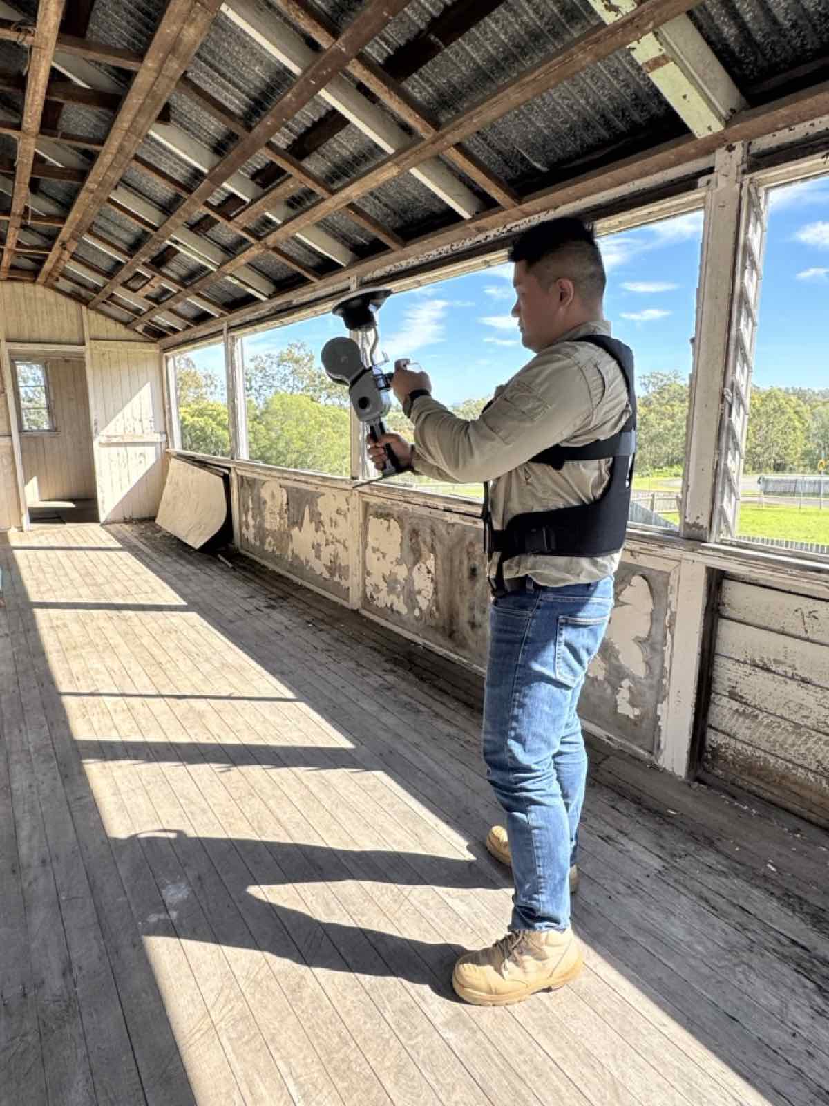
Handheld SLAM capture inside a heritage timber building — one operator, no targets on the fabric.
Queensland Heritage Act 1992 — what documentation is required?
The Queensland Heritage Act 1992 establishes the Queensland Heritage Register and governs how places of cultural heritage significance may be altered, demolished or developed. Development on a registered place generally needs an approval, and that approval typically calls for documented evidence of the place's existing condition and significance. In practice the documentation has to be three things.
- →Measurable — photographs alone are not a measured record for most heritage approval conditions.
- →Comprehensive — the whole of the place must be documented, not only the elements directly affected by proposed works.
- →Archival-quality — sufficient to allow reconstruction of lost fabric if it ever comes to that.
A 3DGS model combined with a survey-grade point cloud satisfies all three, consistent with what Queensland's state heritage branch and local heritage registers expect from a pre-development condition survey. For projects in other jurisdictions, the same workflow aligns with the Australia ICOMOS Burra Charter documentation practice used nationally. Where an approval carries specific conditions, we recommend pre-submission liaison with the approving authority to confirm formats.
Where this workflow gets used
- →Compliance — pre-development condition survey: the baseline an approving authority assesses post-works changes against.
- →Insurance — valuation and loss assessment: an immersive record of condition and fabric, far more useful than photos after fire, flood or storm.
- →Conservation — restoration planning: architects take measurements and model interventions without returning to site.
- →Access — heritage tourism: browser-viewable models embedded on council or museum sites for remote public access.
- →Delivery — adaptive reuse and Scan-to-BIM: a Revit-ready model when a heritage building is converted to a new use.
- →Evidence — dispute resolution: time-stamped spatial evidence for heritage disputes, appeals and insurance claims.
Why a walkthrough stack — and where static scanning still fits
Static tripod-mounted scanners produce geometrically excellent data, and we hold terrestrial LiDAR in the fleet for control networks and structures that demand it. For most heritage documentation, though, the walkthrough stack wins on time and on who can use the result.
- →Setup — static scanning needs a new scanner position per room, 5–20 minutes each; the walkthrough stack is continuous, with no repositioning.
- →Post-processing — manual registration takes hours per site; LCC registers automatically.
- →Viewing the model — vendor point-cloud software versus a standard web browser, no install.
- →A two-storey house on site — half a day or more versus typically under two hours.
- →Output — point cloud only versus a photoreal 3DGS model plus a point cloud (.las / .e57 / .lcc / .ply).
With the Lixel L3, the accuracy argument for static scanning narrows further: 5 mm relative from a handheld unit that walks the building in one pass, with the photoreal record captured alongside it.
Frequently asked questions
What is 3D Gaussian Splatting and how is it different from a photogrammetry model?
3DGS models a space as millions of semi-transparent, ellipsoidal primitives rather than a fixed polygon mesh. Photogrammetry can lose fine surface detail and struggle with reflective or semi-transparent materials; 3DGS preserves depth, texture and photorealistic colour and renders in real time in a browser. For heritage interiors with ornate plasterwork, polished timber, leadlight glass or textured masonry it produces a substantially more faithful record.
Is the capture non-destructive?
Yes. PortalCam and the Lixel scanners are carried through the space by one operator at walking pace. No targets, no adhesive markers, no drilling and no physical contact with original fabric — critical where approval conditions or a conservation management plan prohibit impact on original material.
Which scanner should a heritage consultant buy?
If the deliverable is the photoreal record, PortalCam. If measured drawings and Scan-to-BIM are the core deliverable, the Lixel L3 — its 5 mm relative accuracy and control-point workflow are built for it, and pricing is provided on enquiry after a short consultation. Teams that want one affordable unit for records and 3DGS choose the K2; teams covering large precincts or fusing drone data choose the L2 Pro. You can also hire the K2, L2 Pro and PortalCam before buying.
Does the Lixel L3 replace PortalCam?
No. The L3 is a survey instrument that also captures photoreal colour; PortalCam is a lighter, camera-only 3DGS device for the visual record. On most heritage jobs they run together in one visit.
Does an AECT deliverable satisfy Queensland Heritage Act documentation requirements?
The combined deliverable — a 3DGS model, a colourised LiDAR point cloud and a supporting condition report — meets what is generally expected for a pre-development condition survey in Queensland. For approvals with specific conditions, we liaise with the approving authority before submission and provide a documentation specification statement for the application.
How long does a typical heritage building capture take?
A standard two-storey Queensland heritage house — interior, veranda and immediate curtilage — is typically captured in under two hours with the combined PortalCam and Lixel workflow. Public halls, churches and industrial heritage buildings need more time depending on complexity and access; we give a site-specific estimate during scoping at no charge.
Can the model and point cloud be used in Revit or other BIM platforms?
Yes. LCC exports to Autodesk Revit, ArcGIS and 40+ other platforms. For Scan-to-BIM the L3 or L2 Pro point cloud is imported into Revit as a registered point cloud and the heritage BIM model is developed from it, accelerated by LCC's classification of floors, walls, ceilings and services.
Is all data processed onshore in Australia?
Yes. Capture data is processed and stored in Australia; we do not route project data through overseas cloud infrastructure. That matters for government-listed places, culturally sensitive Indigenous heritage sites and data subject to state or Commonwealth data-sovereignty obligations.
Does AECT work outside Queensland?
Yes. We provide heritage documentation across every state and territory, and founder Jacob Lee is taking the first Australian Lixel L3 on a national roadshow from late September 2026 — register for your state.
Have a heritage documentation project, a pre-development condition survey requirement, or just want to know whether 3DGS suits your conservation project? Book a consultation — Jacob will tell you plainly if the technology is not the right fit. Or get the Lixel L3 spec sheet and browse the live 3DGS gallery.
Related Articles
Talk to Our Team
Every article is backed by real project experience. Book a discovery call and let's discuss your specific project.